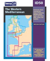
ID50 - Western Mediterranean


new set of Imrays popular digital charts covering the Western Mediterranean from Gibraltar to Italy, Corsica and Sardinia. The disc contains Imray's medium scle charts of this area including all inset plans which are ideal for passage planning. The inclusive plotter program enables integration with a GPS to allow for real time navigation. This digital chart includes the following charts: C19, M10, M11, M12, M13, M14, M15, M3, M6, M8, M9