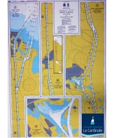
ENHD Suez Canal Chart SC01


Egyptian Navy Hydrographic Department SC1, Suez Canal
Following the establishment of the New Suez Canal, the Suez Canal Authority along with Egyptian Navy Hydrographic Department have produced two charts to help mariners sail safely in the New Suez Canal.
These are:
- SC1, Suez Canal,
- SC2, Suez Canal,
- R11, Suez Canal
Accordingly, sailing in the Suez Canal and vessel inspection will be performed only through charts SC1 and SC2 and no vessel will pass Suez Canal without the above charts being on board starting 06 August 2015.
Suez Canal Port Said to Great Bitter Lake
•Panel A. Port Suez (Bur Said) to El Tina (Km 0 to Km 33) 40,000
•Panel B. El Cap to Al Ballah (Km 28 to Km 57) 40,000
•Panel C. New Expansion Channel (Km 52 to Km 98) 40,000
•Panel D. Al Temsah Lake (Buhayrat Al Yemsah) 40,000