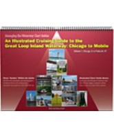
Managing the Waterway - Chicago to Mobile Volume 1


This first volume in a new series covers the Inland Waterway portion of the Great Loop, specifically the Illinois, Mississippi, and Ohio Rivers from Chicago, IL to Paducah, KY. Includes a 30,000-word preparation and planning guide; a complete mile-by-mile cruising guide and an annotated chart guide for the entire 580-mile transit. Also features chart scenarios, GPS waypoints, marinas and anchorages, bridges and locks, boat ramps, interpretive vignettes, websites and phone numbers.